Catalog Archive
Auction 192, Lot 483

"Civitatis Imp. Lindaviensis Territorium. Ita Delineabat Iohannes Andreas Rauben", Blaeu, Johannes

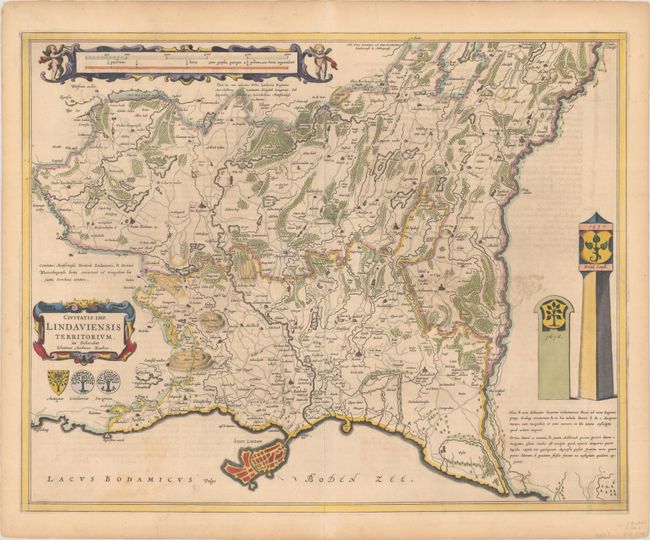
Subject: Southern Germany

Period: 1662 (published)

Publication: Atlas Maior

Color: Hand Color

Size:
22.9 x 18.1 inches
58.2 x 46 cm
Download High Resolution Image
(or just click on image to launch the Zoom viewer)

This exquisitely detailed map shows the region surrounding Lindau, along the northeastern shore of Lake Constance (Bodensee). The cartography is based on the work of Johann Andreas Rauch and includes tiny towns, roads, creeks, ponds, hills, and more. The map is handsomely adorned with strapwork cartouches, putti, coats of arms, and two monuments. Latin text on verso.

References: Van der Krogt (Vol. III) #2610/1:2.

Condition: B+

A nice impression on a lightly toned sheet with a large elephant watermark, a bit of show-through of text on verso, and two short edge tears at top that have been closed on verso with old paper.

Estimate: $240 - $300

Unsold

Closed on 4/26/2023

Archived