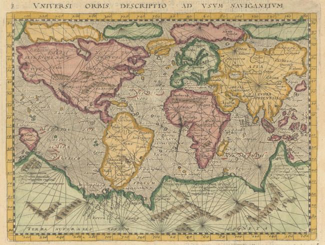
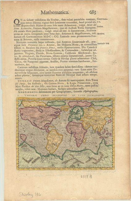
Subject: World
Period: 1657 (published)
Publication: Studium Sapientiae Universalis
Color: Hand Color
Size:
6.8 x 5 inches
17.3 x 12.7 cm
This small mariner's map is based on one of the most important world maps of the 16th century: Gerard Mercator's multi-sheet map of 1569. The map reflects the belief in wide Arctic sea passages and depicts a huge southern continent, to which Magini has added fanciful ranges of mountains. A fine network of rhumb lines crisscross the map, and the oceans are stipple engraved in the Italian style. Printed on a full sheet of Latin text (8.6 x 13.6"), with the text below the map providing navigational instructions. The map was engraved by Girolamo Porro and first published in an edition of Ptolemy's Geography that was edited by the distinguished Italian geographer Giovanni Magini. This example comes from Léon de Saint-Jean's Studium Sapientiae Universalis. Contextus Scientiae-Humanae.
References: Shirley #196.
Condition: B+
A lightly toned sheet with a large coat of arms watermark, a chip at left, and dampstains along the edges of the sheet.