Subject: Peru
Period: 1630 (circa)
Publication: Nieuwe Wereldt ofte Beschrijvinghe van West-Indien…
Color: Black & White
Size:
14 x 11.1 inches
35.6 x 28.2 cm
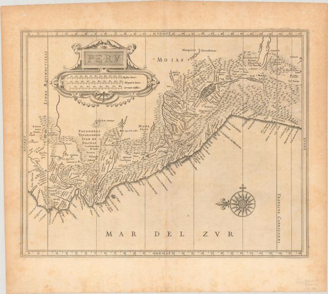
This great map is a foundation map for later Dutch maps of Peru. The map is the work of Hessel Gerritsz, one of the truly important Dutch cartographers of the 17th century. Most of his work was only done in manuscript and these maps, published by De Laet, are the only Gerritsz maps available to the collector today. The map vividly depicts the mountainous region and the large Lake Titicaca that is dotted with islands. A splendid strapwork title cartouche and compass rose adorn the map.
References: Shirley (BL Atlases) G.LAET-1b #8.
Condition: B+
A crisp impression on a lightly toned sheet with the watermark of an eagle with an "R" on its chest. There is light foxing and a few small worm holes, two of which are in the image at far right and left.