Subject: Austin, Texas
Period: 1949-53 (dated)
Publication:
Color:
This lot features two early post-war folding maps of Austin:
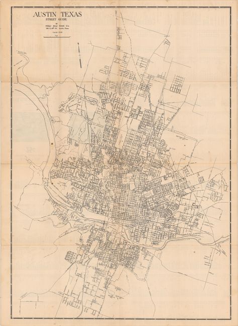
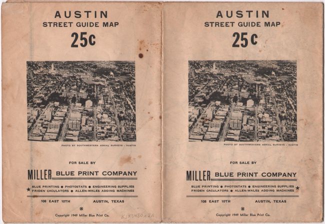
A. Austin Texas Street Guide, by Miller Blue Print Co., dated 1949, black & white (20.4 x 28.9"). A very detailed street map with the University of Texas at center. The street-grid extends to both sides of the Colorado River and locates the state capitol, airport, hospital, railroads, and more. Verso features a detailed street index. Self-folding (5.5 x 7.5"). Condition: Issued folding with a few small stains. There are a few short splits at the fold junctions with minor loss of image.
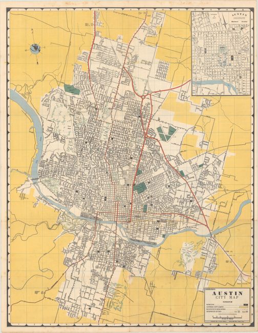
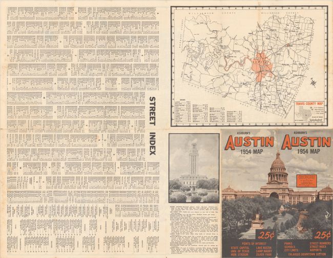
B. Ashburn's Austin City Map, by J. Foster Ashburn, dated 1953, printed color (16.4 x 21.1"). Presented with Ashburn’s distinctive coloring, this map shows the street-grid pattern of the city along with an inset of downtown at top right. The verso includes a street index and small map of Travis County. Self-folding (3.7 x 8.5') with an image of the state capitol on the wrappers. Condition: Issued folding with light foxing and a couple of short splits at the fold junctions.
References:
Condition: B+
See description above.