Subject: Dallas, Texas
Period: 1930 (dated)
Publication:
Color: Printed Color
Size:
25.4 x 40.8 inches
64.5 x 103.6 cm
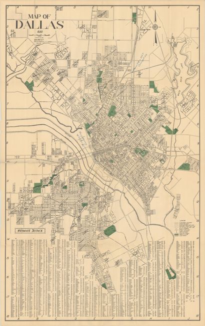
This large and detailed street map of Dallas was produced by M.H. West. It covers the area from University Heights south to Glendale Park with numerous parks, golf courses, schools, fire stations, railways and streetcar lines identified. Includes an extensive street index at bottom. Dallas’ population at the time of publication was 260,000. We found only one institutional example of a 1928 edition of this map and no reference to this 1930 edition.
References:
Condition: B
Issued folding with several small holes along the center vertical fold. There are numerous fold separations and one small tear that have all been closed on verso with archival tape. A couple of colored pencil notations are visible in the image.