Subject: Rhode Island
Period: 1824 (published)
Publication: A New General Atlas...
Color: Hand Color
Size:
8.7 x 11.4 inches
22.1 x 29 cm
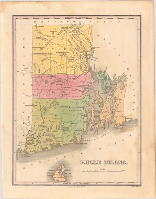
Finely's maps employ a delicate and elegant engraving style and provided extensive topographical and watershed information. He was the dominant map maker in the United States in the early 1820s into the 1830s. His atlases were very successful, outselling rival atlases by Carey & Lea, and Tanner. His maps were printed on high quality paper and were routinely corrected and updated.
This first edition copper engraved map shows the county seats, roads, towns and settlements, rivers, and coastal detail. It is filled with interesting features including several turnpikes: Chepachet, Norwich, Pawcatuck, Providence & Douglass, and the Rhode Island & Connecticut. Also locates Tift's Hill, Block Island, the Were Bridge, Ten rod road, numerous mills, and more. Clearly shows the five counties of Providence, Kent, Washington, Worth, and Bristol. Engraved by Young & Delleker. Finley published his atlases annually between 1824-1834, with one final edition appearing in 1836 (Ristow states his last atlas was 1834).
References: Ristow, pp. 268-70.
Condition: B
Contemporary color with minor foxing and light dampstains at right.