Subject: Oklahoma
Period: 1886-87 (circa)
Publication:
Color: Printed Color
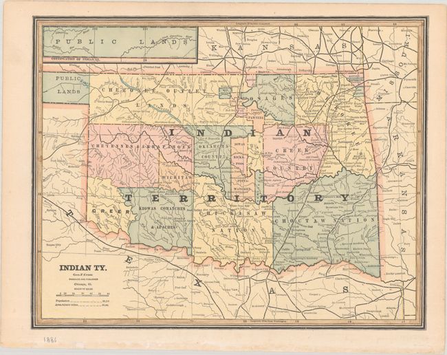
A. Indian Ty., by George F. Cram, from Cram's Superior Atlas of the World, circa 1886 (12.1 x 9.6"). This handsome atlas map shows Indian Territory prior to the creation of Oklahoma Territory in 1890. It divides the region into the lands of multiple tribes, including the Cherokees (with an additional Cherokee Outlet Lands); Osages; Cheyennes and Arrapahoes; Creeks; Kiowas, Comanches, and Apaches; Chickasaws; Choctaws; and more. The public lands of the panhandle are continued in an inset at top left. The population is noted as 68,152.
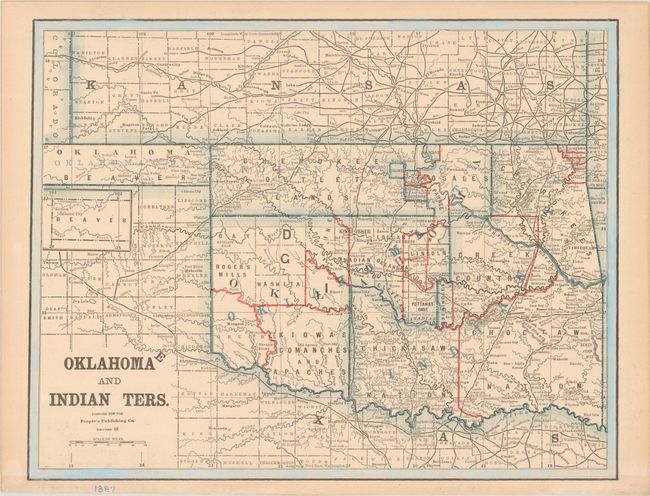
B. Oklahoma and Indian Ters., by People's Publishing Co., from People's Illustrated Atlas, circa 1892 (13.1 x 10.3"). This nicely detailed atlas map shows Indian Territory along with the newly incorporated Oklahoma Territory. County configuration is current to 1892 with the addition of the counties of Blaine, "D" (Dewey), Day, G, and Roger Mills. The boundaries of various tribal lands are defined.
References:
Condition: A
Minor toning and a few short edge tears, all confined to the blank margins.