Subject: Oklahoma
Period: 1849 (circa)
Publication: House Ex. Doc. No. 104, 35th Congress, 1st Session
Color: Black & White
Size:
37 x 23.7 inches
94 x 60.2 cm
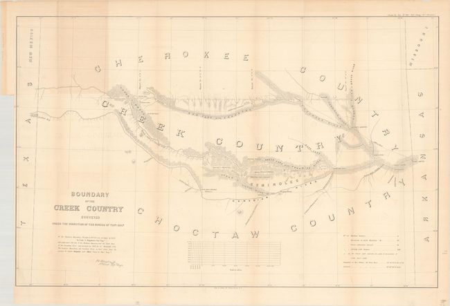
The area covered by Sitgreaves' large map lies in the watershed of the Canadian River and Red Fork of the Arkansas River in Indian Territory. It extends from Fort Smith to the border with Texas and New Mexico Territory. The lands of the Cherokee, Creek, Seminole and Choctaw Indians are located. The map locates numerous forts, including Smith, Coffee, Gibson and Old Fort Holmes, and their connecting wagon roads. Talasee is shown at the site of Tulsa. There are other interesting place names such as Post Oak and Black Jack. An uncommon map.
References: Phillips (Maps) p.251.
Condition: B+
Folding as issued with minor offsetting, light toning along some folds and a segment at top where the map was attached to the report, and a couple of very short tears at fold intersections.