Subject: New York City, New York
Period: 1865-82 (dated)
Publication:
Color: Hand Color
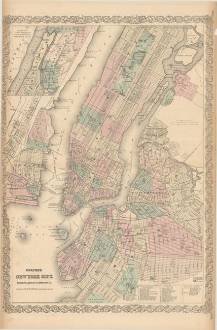
A. Colton's New York City, Brooklyn, Jersey City, Hoboken, Etc., by G.W. and C.B. Colton & Co., dated 1865 (17.2 x 24.2"). This double-page map covers Manhattan to 125th Street, along with Long Island City, Brooklyn, Hoboken, and Jersey City. An inset at top left extends the main map up to Yonkers. Highly detailed, the map shows the street grid pattern, parks, railroads, ferry routes, and docks. The map was published before the construction of the Brooklyn Bridge, though a "suspension bridge" is drawn in its location indicating the bridge was in the planning phase (construction began in 1869). Reference: Phillips (Maps) p. 537. Condition: There is light toning along the sides of the sheet and short centerfold separations that extend about 1" into the image at left and right that have been closed on verso with archival tape.
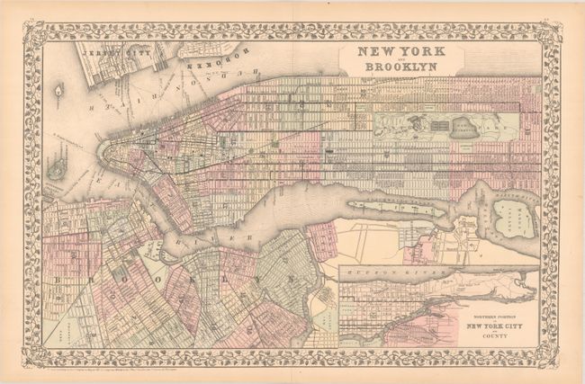
B. New York and Brooklyn, by S. Augustus Mitchell, dated 1882 (21.0 x 13.6"). A nice map of Manhattan that stretches from Battery Park to Central Park and extends to include portions of Brooklyn and Jersey City. The northern part of Manhattan continues in an inset at lower right. The map was issued just one year before the completion of the Brooklyn Bridge, which is noted as a "suspension bridge." Condition: Issued on a clean bright sheet with a 2.25" centerfold separation at top that has been closed on verso with archival tape.
References:
Condition: B+
See description above.