Subject: New York City, New York
Period: 1852 (dated)
Publication: Manual of the Corporation of the City of New York
Color: Hand Color
Size:
8.8 x 12.3 inches
22.4 x 31.2 cm
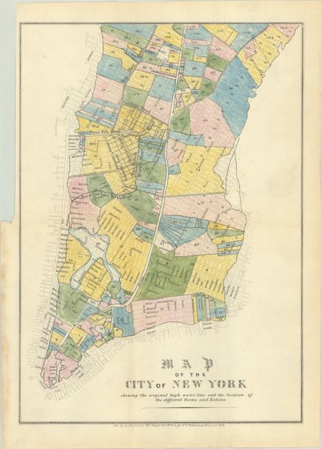
This is an interesting small map of New York City, which is drawn to show the high water line, demonstrating those areas that are prone to flooding. The map is also color coded to show city wards and locates important streets.
George Hayward was a New York City lithographer best known for his views and maps of New York City, including those published in D.T. Valentine's annual manuals for the city between 1841 and 1866. The manual was a directory with extensive historical and contemporary records related to New York, including ordinances, lists of public officials, ferry schedules, and the directories of hospitals and schools.
References:
Condition: A
Full contemporary color on a bright sheet, issued folding with a tiny pinhole at top right, a binding trim at left, and some staining along the left edge of the sheet where the map was glued into the manual.