Subject: Montana
Period: 1892 (published)
Publication: Sen. Ex. Doc. 58, 52nd Congress, 1st Session
Color: Printed Color
Size:
39 x 26.3 inches
99.1 x 66.8 cm
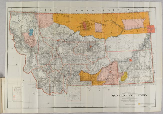
This uncommon and large map, dated 1887, shows in great detail the extent of public surveys in Montana just prior to its statehood in 1889. It locates military posts (Assiniboine, Keogh, Maginnis, Custer, Camp Baker, and more), Custer Hill, Custer's Monument, and the Reno battlefield. Yellowstone National Park is shown in its entirety with major features. An extensive legend identifies land offices, Surveyor Generals Office, county seats, towns, villages, railroad stations, railroads (completed and proposed), military reservations, Indian reservations, railroad land grant limits, and more. Hydrology and topography are well developed. The map is accompanied by the original 185-page report to Congress concerning the fragmentation of the Great Sioux Reservation in 1889. The report covers the events that led up to the Wounded Knee Massacre. Hardbound in beige cloth.
References:
Condition: A
The map is very clean and colorful with faint color offsetting and a couple of tiny splits at the fold junctions. Report text has a hint of pleasant light toning. Modern binding is fine.