Subject: Missouri
Period: 1824 (published)
Publication: A New General Atlas...
Color: Hand Color
Size:
8.8 x 11.4 inches
22.4 x 29 cm
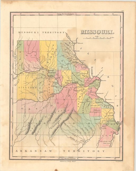
Finely's maps employ a delicate and elegant engraving style and provided extensive topographical and watershed information. He was the dominant map maker in the United States in the early 1820s into the 1830s. His atlases were very successful, outselling rival atlases by Carey & Lea, and Tanner. His maps were printed on high quality paper and were routinely corrected and updated.
First edition map of the state that was engraved less than three years following statehood. It details the county seats, towns and settlements, rivers and topography. Development is primarily along the rivers with virtually no other settlements noted. The map shows 27 counties, correct for 1824, includes the 1824 gain from Girardeau county by Scott. Engraved by Young & Delleker. Finley published his atlases annually between 1824-1834, with one final edition appearing in 1836 (Ristow states his last atlas was 1834).
References: Ristow, pp. 268-70.
Condition: B
Contemporary color with scattered foxing and a dampstain at upper right. A pencil drawing on verso slightly shows through.