Subject: World
Period: 1810 (circa)
Publication: Nouvel Atlas de la Bible
Color: Hand Color
Size:
18.1 x 15.5 inches
46 x 39.4 cm
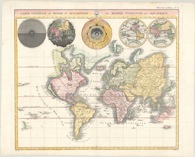
This is a re-engraved edition of Pierre Mortier's unique world map drawn on Mercator's projection. It depicts California as an island and the Detroit d'Anian connected by dotted lines through the Northwest Passage to Button's Bay located to the west of Hudson Bay. There is an erroneous large lake shown as the source for the Rio Norte (Rio Grande River) located in the Southwest, as well as an early, open-ended version of the Great Lakes named Mer Douce. A small coastline of New Zealand appears in the Pacific. The northeast coast of Asia is severely truncated and shows Witsen's Cap de Glaces. Australia's northern coast is shown nearly connected to New Guinea, and a partial coastline of Van Diemen's Land appears to the south. The most interesting features of the map are the five spheres presented along the top depicting day and night, the flood, the phases of the moon, and the Western and Eastern Hemispheres. This edition was precisely engraved by C.B. Glot.
References: cf. Shirley #622.
Condition: A
A crisp impression on a bright sheet with minor marginal soiling.