Subject: Maryland
Period: 1824 (circa)
Publication: A New General Atlas…
Color: Hand Color
Size:
11.4 x 8.8 inches
29 x 22.4 cm
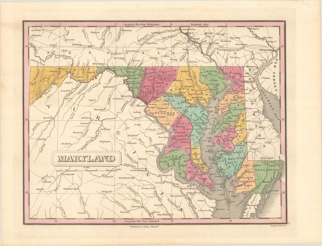
Finely's maps employ a delicate and elegant engraving style and provided extensive topographical and watershed information. He was the dominant map maker in the United States in the early 1820s into the 1830s. His atlases were very successful, outselling rival atlases by Carey & Lea, and Tanner. His maps were printed on high quality paper and were routinely corrected and updated.
This copper engraved map of the state details the county seats, roads, towns and settlements, and watershed. Locates the District of Columbia which was created (in part) from a portion of Montgomery and Prince George's county. Engraved by Young & Delleker. According to Ristow, Finley published his atlases between 1824 to 1834, with separate issues published in the years 1824, 26, 29, 30, 31, 33 and 1834.
References: Ristow, pp. 268-70.
Condition: A+
A strong impression on a clean sheet with attractive color.