Subject: Maine
Period: 1801 (circa)
Publication: American Pocket Atlas
Color: Black & White
Size:
5.8 x 7.6 inches
14.7 x 19.3 cm
Mathew Carey was a seminal figure in early American publishing; establishing the first publishing firm to specialize in cartography and issuing the first atlas devoted exclusively to American maps. He set up an elaborate cottage system of craftsmen for compiling, engraving, printing, and coloring maps. This practice was emulated by later American cartographic publishers such as John Melish and Henry S. Tanner. The American Atlas concept was also adopted by other publishers in both the United States and Europe.
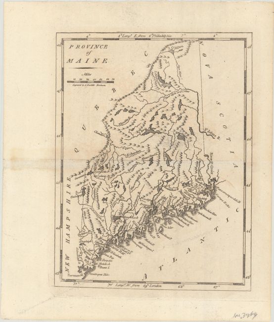
This is the second state of Carey's small map of Maine, having been first published in 1796. The Spye River runs south to the St. John's River, and double-line wagon roads along the coastline connect Portsmouth to the Schoodic River near the border with Nova Scotia. Locates Cape Neddick, Portland, Casco Bay, Monhegan Island, Belfast, and Moosehead Lake to name a few. Additional place names on this second edition include Campo Bello, Prospect, Passconaquoddi, and more. Engraved by Amos Doolittle.
References: Wheat & Brun #174.
Condition: A
A nice impression with a hint of offsetting.