Catalog Archive
Auction 192, Lot 251

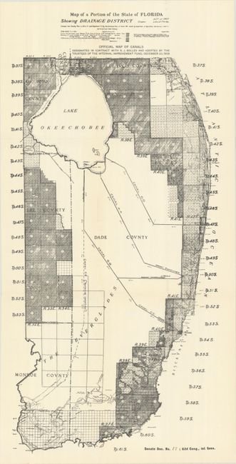
Map Used to Promote Questionable Florida Land Sales

"Map of a Portion of the State of Florida Showing Drainage District … Official Map of Canals...", U.S. Government

Subject: Florida

Period: 1911 (circa)

Publication: Sen. Doc. 89; 62nd Congress, 1st Session

Color: Black & White

Size:
10.8 x 22.3 inches
27.4 x 56.6 cm
Download High Resolution Image
(or just click on image to launch the Zoom viewer)

This detailed map was issued in a federal report known as the Wright report that illustrated a proposed project which would create drainage canals from Lake Okeechobee through the Everglades to the sea. The report concluded that the project would be easy and cheap, triggering a speculative land boom. Even after the canal project failed and the report’s findings were shown to be based on faulty engineering, politicians and promoters persisted in using the “official report” and map to sell land, mostly to northern buyers.

References:

Condition: A+

Fine, issued folding.

Estimate: $140 - $170

Sold for: $160

Closed on 4/26/2023

Archived