Subject: Florida
Period: 1855 (dated)
Publication: Sen. Ex. Doc. No. 1, 34th Congress, 1st Session
Color: Black & White
Size:
26.6 x 24.3 inches
67.6 x 61.7 cm
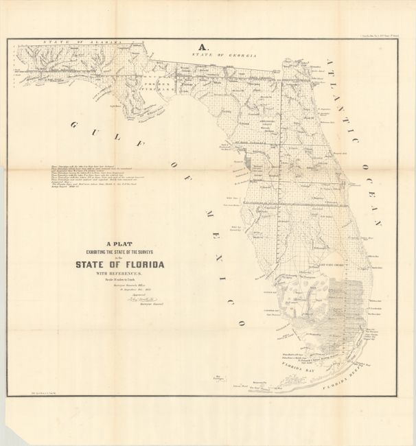
This 1855 edition shows up-to-date survey progress and development in the state. The map shows the entire state to include Key Largo and features the Forbes Purchase and the Arredondo Grant lands. Numerous forts are located including Lauderdale, Howell, Foster, Thompson, Adams, and many more. Key Biscayne is identified, but Miami is not yet named. This map was produced at the end of a period of relative peace between the U.S. and Seminole Nation. The third and final Seminole War waged between 1855 and 1858. Extensive legend gives survey status for townships. From the Surveyors Office in St. Augustine, October 1855 by John Wescott, Surveyor General.
References:
Condition: B+
Issued folding on a bright sheet with minor toning along the folds and some faint spots of foxing. There is a biding trim at left with a related 1" binding tear that has been closed on verso with archival tape.