Subject: Florida
Period: 1845 (dated)
Publication: Meyer's Handatlas
Color: Hand Color
Size:
11.9 x 14.6 inches
30.2 x 37.1 cm
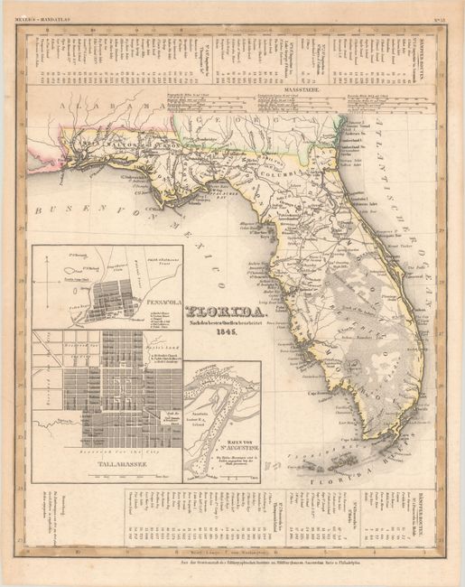
This is an interesting German map of the state of Florida based on the important Mitchell series showing towns, forts, roads, canals, major rivers. and lakes. There are three inset maps detailing Pensacola, Tallahassee, and St. Augustine. The map reflects the configuration of counties in 1835 prior to the organization of Dade County. Central Florida is dominated by a large Indian Reserve with a "Track of the Indians" noted from Tampa to Jupiter. Water routes from St. Augustine and Pensacola to various ports are described above and below the map.
References:
Condition: B+
Contemporary outline color with light toning and a few minor spots.