Subject: New Haven, Connecticut
Period: 1836 (dated)
Publication:
Color: Hand Color
Size:
15.6 x 25.4 inches
39.6 x 64.5 cm
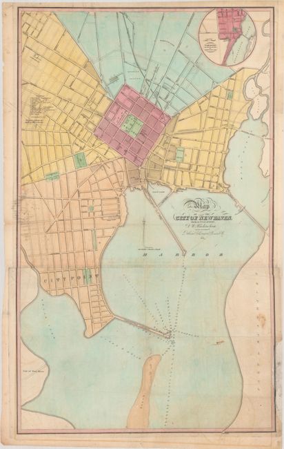
This rare early plan of New Haven was drawn by David Buckingham, County Surveyor, and issued on two sheets and joined. The majority of the city is depicted on the upper sheet and locates Court Square, State House (built in 1828), and Yale College. The lower sheet extends to City Point and depicts a "contemplated" Commercial Wharf reaching out into the New Haven Harbor. Navigational details surround this proposed structure including soundings, shoals, and a buoy. Features an inset of Fair Haven at top right and a key at left that identifies 12 churches. Published by Daggett, Hinman & Company. The top sheet of this map was first issued in 1830 and again in 1849. This 1836 two-sheet edition appears to be rare with no other examples offered for sale and no institutional examples located on OCLC or elsewhere.
References:
Condition: B
Issued folding on thin banknote-style paper with faint offsetting, minor soiling, and several tiny holes and separations only visible when held to light. There is an archivally repaired 7" edge tear at bottom right and a 4" chip along the lower right border that has been replaced with border drawn in facsimile. Occasional light pencil notations in the image indicate this was a working example.