Subject: Los Angeles, California
Period: 1927 (dated)
Publication:
Color: Printed Color
Size:
18.4 x 21.3 inches
46.7 x 54.1 cm
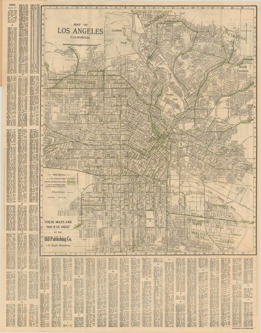
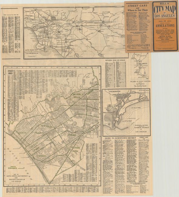
This detailed folding map by E.F. Hill extends from Inglewood and Huntington Park north to Griffith Park and Pasadena. A legend identifies the transportation network within the city, including the Los Angeles Railway, Pacific Electric Railway, bus lines, and railroads. The verso contains several additional maps including a large "Map of Santa Monica Bay District," highway map of Southern California, and "Harbor District of Los Angeles." Santa Monica map on verso is copyright dated 1927. Folds into paper wrappers (3.9 x 7.4").
References:
Condition: B+
Issued folding with a hint of offsetting and a tiny hole along the top left border. Paper wrappers have light wear.