Catalog Archive
Auction 192, Lot 232

First “Official” Map of Los Angeles

"Topographical Sketch of the Los Angeles Plains & Vicinity August 1849", Ord, E. O. C.

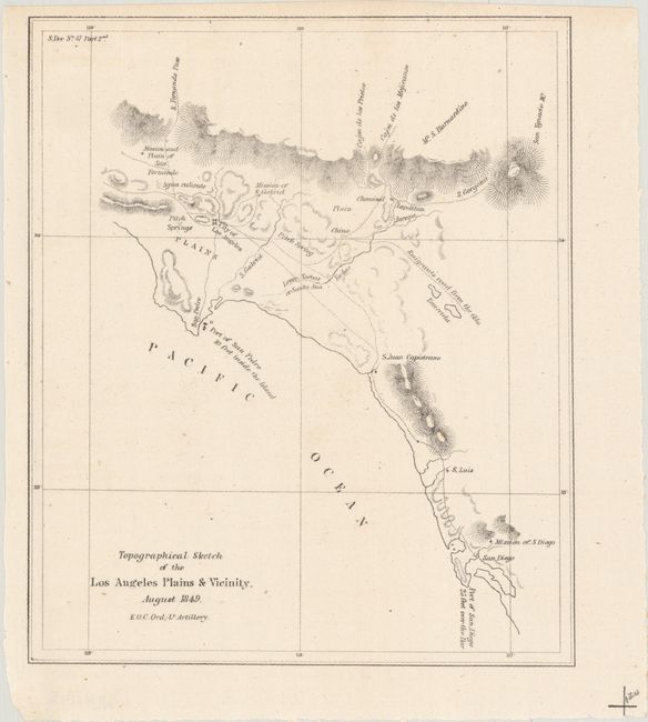
Subject: Los Angeles, California

Period: 1849 (dated)

Publication: Sen. Ex. Doc. 47, 31st Congress, 1st Session

Color: Black & White

Size:
6.2 x 7.3 inches
15.7 x 18.5 cm
Download High Resolution Image
(or just click on image to launch the Zoom viewer)

This small map of Los Angeles was issued in Philip Tyson's report concerning the geology and topography of the area between San Francisco and the Gold Region. The Ruderman Map Collection at Stanford describes this sketch as “a curious addition to a publication whose real subject matter was the discovery of Gold in California. Nevertheless, it is of great significance as the first map done by Ord and also the first 'official' map of Los Angeles" (click here for more details.) Because military salaries could not keep up with Gold Region price inflation, Ord was authorized to work for local officials and produced this first formal survey of nascent Los Angeles and the surrounding region.

References:

Condition: A+

Issued folding.

Estimate: $160 - $190

Sold for: $210

Closed on 4/26/2023

Archived