Subject: Alaska
Period: 1801 (circa)
Publication: Atlas du Voyage de Decouvertes, a l'Ocean Pacifique...
Color: Black & White
Size:
10.8 x 8.3 inches
27.4 x 21.1 cm
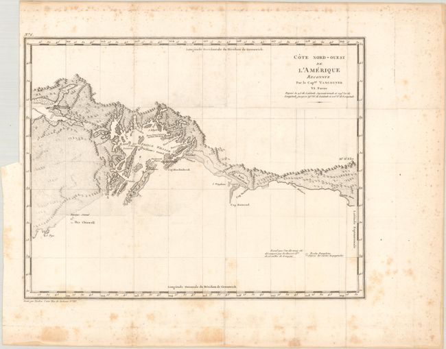
This map comes from a French octavo edition of Vancouver's Voyages. It covers the Alaskan coast from Mt. St. Elias in the east to Prince William Sound and the eastern side of the Kenai Peninsula in the west. The map features good detail of the mountainous interior and numerous offshore islands. Engraved by Tardieu.
During the summers of 1792-94, George Vancouver and the crew of the British naval ships Discovery and Chatham mapped the northwest coast of North America from Baja California to Alaska. Vancouver's voyage was the last, and longest, of the great Pacific voyages of the late eighteenth century. Taking the art and technique of distant voyaging to a new level, Vancouver eliminated the possibility of a Northwest Passage and his remarkably precise surveys completed the outline of the Pacific. His expedition was also partially responsible for the British domination of Australia and New Zealand and the establishment of the Kingdom of Hawaii through his assistance to Kamehameha I, the king of Hawaii.
References: Howes #V-23.
Condition: B+
Issued folding with light scattered foxing that is mostly in the blank margins. There is a binding trim at upper left.