Subject: Northwestern United States
Period: 1865 (dated)
Publication:
Color: Hand Color
Size:
23.2 x 17 inches
58.9 x 43.2 cm
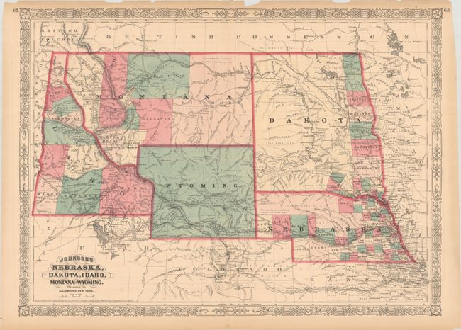
This colorful double-page map shows an early rendering of Wyoming Territory, organized in 1868. The territory's western boundary is not fully established, with a bulge extending above Idaho with Idaho occupying western Wyoming south of Jackson Hole. The map correctly delineates Montana which, along with Wyoming, was previously contained in a large Idaho territory. Dakota Territory, from which Wyoming was formed, remains undivided with county development confined to its eastern boundary along the Red River of the North. There is excellent detail throughout with scores of place names, wagon roads, rivers, topography, the Emigrant Road, forts, springs, routes of exploration, and proposed railroads. The route of the Pony Express & U.S. Mail Route through Utah, Wyoming and Nebraska is delineated.
References:
Condition: B+
Contemporary color with short centerfold separations at top and bottom that have been closed on verso with archival tape. The upper right side margin has been partially trimmed and there are a couple of small chips and edge tears confined to the margins.