Subject: Northwestern United States
Period: 1853 (dated)
Publication:
Color: Hand Color
Size:
16.3 x 13 inches
41.4 x 33 cm
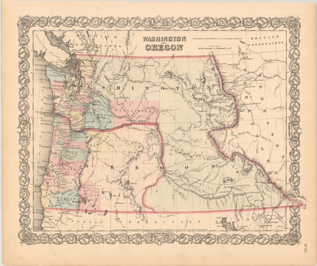
A handsome and colorful map of the Pacific Northwest with Washington Territory wrapping around the new state of Oregon and extending south to Utah and east to Nebraska Territory. The map was likely published shortly after statehood (1859) as it reflects the state's new boundaries, but the name Oregon still stretches out to the Continental Divide, positioned with its former territorial configuration. County development is mostly limited to the coastal areas and are current up to 1856, with Josephine County formed from Jackson County (though their positions are reversed). Very little information is displayed in the area of today's Idaho except for Fort Hall, the nearby Cantonment Loring, and an early reference to Soda Springs as "Beer or Soda Springs." The map locates numerous forts including Boise, Benton, Owen, Colville, and Hall. The important landmarks of Three Buttes and the Three Tetons are noted in the lower portion of Washington Territory.
References:
Condition: A
Minor toning along the sheet edges.