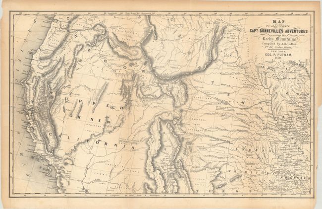
Subject: Western United States
Period: 1850 (dated)
Publication: Irving's Adventures of Captain Bonneville
Color: Black & White
Size:
18.3 x 11.3 inches
46.5 x 28.7 cm
This interesting map is based on Fremont's map. The region west of the Mississippi to the Pacific Ocean is delineated with the rivers and towns of the gold region in California well depicted. The expedition route described is that of Captain Benjamin Bonneville who explored the American West from 1832-1836. The expedition party traveled parallel to the course of the Snake and the Columbia Rivers, going as far as Fort Walla Walla before turning back. Fremont's route through California is shown, as well as Kearny's route along the Gila River and the Emigrant route.
References: Wagner-Camp #67:14, cf. Wheat (TMW) #424.
Condition: B+
Issued folding with light toning, a binding tear at right, and a short binding tear that has been closed on verso with archival material. Remnants of hinge tape on verso.