Subject: World
Period: 1770 (circa)
Publication:
Color: Hand Color
Size:
25.8 x 16.9 inches
65.5 x 42.9 cm
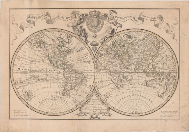
This impressive, large double-hemisphere map is based on the work of Delisle, with the latest discoveries of the previous 30 years, as mentioned in the cartouche at bottom. The routes of numerous explorers are depicted, including Magellan (1520), Mendanna (1595), Quiras (1605), Le Maire (1615), Tasman (1642), St. Louis (1708), and Antoine (1710). The colonies are confined to the eastern seaboard in North America with Louisiane encompassing the interior. The western portion of North America is still largely blank with the exception of a large Mer de l'Ouest. A broken coastline continues to the northwest with several notes of explorers' discoveries. Australia and New Zealand are only partially mapped, and there is no sign of Hawaii, indicating that this map does not include updates based on Captain Cook's second and third voyages. Above the map is a decorative cartouche featuring the French coat of arms surrounded by allegorical figures representing the four continents. This is the fourth state, with the additional coastline added to the northwest coast of North America. Engraved by J. Condet. Printed on two joined sheets, as issued.
References: McGuirk #82.
Condition: B+
Contemporary outline color on a lightly toned sheet with a "C&I Honig" watermark. There is light soiling mostly along the right edge of the sheet, a few small stains, and a chip along the bottom edge of the sheet.