Subject: Georgia & Alabama
Period: 1824 (published)
Publication: A New General Atlas...
Color: Hand Color
Size:
8.7 x 11.4 inches
22.1 x 29 cm
Finely's maps employ a delicate and elegant engraving style and provided extensive topographical and watershed information. He was the dominant map maker in the United States in the early 1820s into the 1830s. His atlases were very successful, outselling rival atlases by Carey & Lea, and Tanner. His maps were printed on high quality paper and were routinely corrected and updated.
Two state maps from Finley's first edition A New General Atlas:
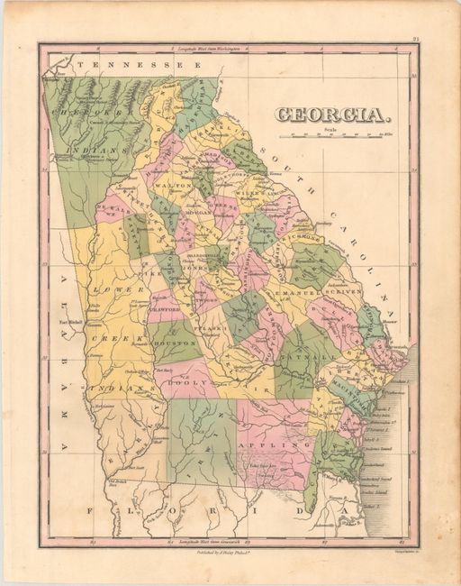
A. Georgia. Attractive map of the state that details the roads, towns and settlements of the day. Numerous counties are delineated via hand coloring and engraved lines, and the majority of roads radiate from Greensboro. The northwest corner is unorganized and labeled Cherokee Indians with three missionary stations identified, and to its south are lands identified as Lower Creek Indians. Engraved by Young & Delleker. Condition: Minor foxing mostly at bottom left. (B+)
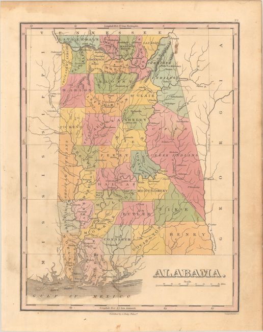
B. Alabama. An early map of the state with only 35 counties. Two large regions in the east are unorganized and labeled Cherokee Indians and Upper Creek Indians, while a small area in the northwest is Chickasaw Indians. A detailed map that presents the county seats, settlements, forts, roads, and more. Condition: Scattered foxing with a light dampstain along the top sheet edge. A pencil drawing on verso does not show through. (B)
Finley published his atlases annually between 1824-1834, with one final edition appearing in 1836 (Ristow states his last atlas was 1834).
References: Ristow, pp. 268-70.
Condition:
Contemporary color. See description above.