Subject: Mid-Atlantic & Central United States
Period: 1812 (dated)
Publication:
Color: Hand Color
Size:
9.7 x 7.8 inches
24.6 x 19.8 cm
Mathew Carey was a seminal figure in early American publishing; establishing the first publishing firm to specialize in cartography and issuing the first atlas devoted exclusively to American maps. He set up an elaborate cottage system of craftsmen for compiling, engraving, printing, and coloring maps. This practice was emulated by later American cartographic publishers such as John Melish and Henry S. Tanner. The American Atlas concept was also adopted by other publishers in both the United States and Europe.
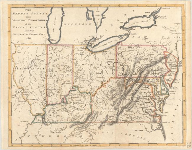
This map covers the region from New Jersey to Illinois and names Indiana, Kentucky, Virginia, Ohio, Pennsylvania, Maryland, and Delaware. The northern borders of Illinois and Indiana are aligned with Ohio, so they are south of Lake Michigan. Chicago and Fort Dearborn are correctly on the lake, but occupy an unnamed region west of Lake Michigan. Michigan is named, and Detroit is located. The capitals of Illinois, Indiana, and Ohio are given as Kaskaskia, St. Vincennes, and Chilicothe, respectively. The map was made to show the region involved in the War of 1812 with the British.
References:
Condition: B+
Issued folding with minor toning and offsetting. Remargined at right with period-correct paper.