Catalog Archive
Auction 192, Lot 172

"Gli Stati Uniti dell' America Delineatio Sulle Ultime Osservazioni - Quarto Foglio che Comprende Parte della Nuova Inghilterra, la Nuova York, il Nuovo Yersey, la Pensilvania, il Delaware, il Maryland, e Porzioni della Virginia, e della Carolina", Cassini, Giovanni Maria

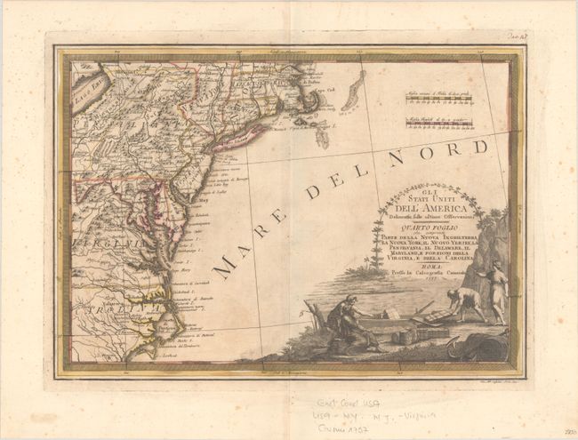
Subject: New England & Mid-Atlantic United States

Period: 1797 (dated)

Publication: Nuovo Atlante Geografico...

Color: Hand Color

Size:
18.8 x 13.4 inches
47.8 x 34 cm
Download High Resolution Image
(or just click on image to launch the Zoom viewer)

This uncommon map was part of Cassini's six-sheet representation of the settled portions of North America. Cassini drew largely from the Zatta-Mitchell map of North America. It shows the new United States from Massachusetts to Cape Hatteras in North Carolina and inland to Lake Erie. The map includes Pennsylvania, New York, Connecticut, New Jersey, Delaware, Rhode Island, Maryland and a part of Virginia. The map is quite detailed, and includes roads and topography in addition to many place-names, from Boston and Capo Cod to Filadelfia. The title cartouche features a landscape showing a rowboat being loaded with supplies.

References: McCorkle #797.3; Portinaro & Knirsch #167.

Condition: B+

A dark impression with full contemporary color on a sheet with a "PM" watermark, light scattered foxing, and a minor extraneous horizontal crease.

Estimate: $800 - $950

Unsold

Closed on 4/26/2023

Archived