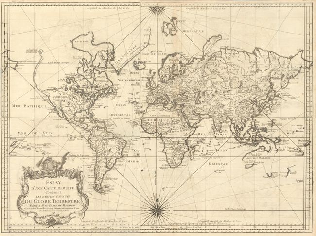
Subject: World
Period: 1748 (dated)
Publication:
Color: Black & White
Size:
14.1 x 9.4 inches
35.8 x 23.9 cm
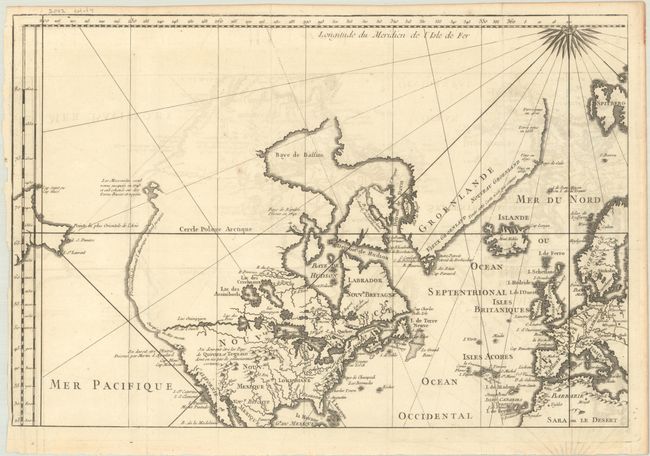
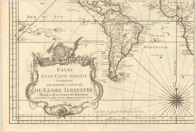
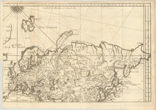
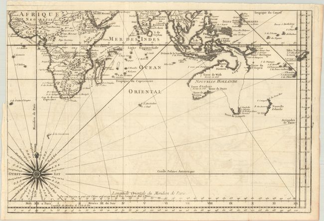
Early issue on four sheets of this fine large world chart on Mercator's projection decorated with a large title cartouche and two compass roses. North America is shown with a very pronounced River of the West connecting through a series of rivers and lakes from Lake Superior to the Pacific - representing the elusive Northwest Passage. The Russian discoveries in the North Pacific are not yet shown, although there is a note about the voyages of 1743. Australia is labeled Nouvelle Hollande with Terre de Diemen and Nouv. Guinee both linked to the mainland by conjectural coastlines. New Zealand is only partially formed, and there are numerous islands in the Pacific. If joined together, the map would measure approximately 27.5 x 19.7".
References:
Condition: B+
Issued folding on watermarked paper with light offsetting. Each sheet has a side that is trimmed close where it was previously bound. The first image is a composite image - the map is in 4 separate sheets.