Subject: Western Hemisphere - America
Period: 1782 (dated)
Publication:
Color: Hand Color
Size:
19.8 x 19.9 inches
50.3 x 50.5 cm
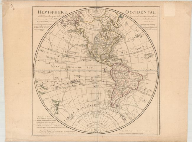
This fine map shows various explorers' routes through the Western Hemisphere. It is an updated edition of a map first issued by Delisle in 1724. According to Tooley, this is the fifth state of the map, after revisions by Buache and Covens and Mortier. The map has been redrawn to reflect the discoveries of Captain Cook. The present-day United States is divided into the colonies along the east coast, a large Florida that extends into much of present-day Georgia, a massive Louisiane territory, Nouveau Mexique,, and Californie. Quivira is located at the inland terminus of the Colorado River. A note by the Strait of Juan de Fuca mentions that the Spanish discovered the R. de l'Ouest in 1603, but the river itself is not delineated. The cartography of the northwestern coast of North America has been greatly improved from past versions of the map, and New Zealand's coastlines are up-to-date. Although still dated 1782, this edition was published circa 1792 as all references to the King have been removed.
References: Tooley (Amer) p. 18 #27.
Condition: B+
A nice impression with contemporary outline color on a watermarked sheet with very light toning, a bit of soiling, some extraneous creasing along the centerfold and edges of the sheet, and damp stains in the top corners of the sheet.