Subject: Atlases
Period: 1751 (circa)
Publication:
Color: Hand Color
Size:
13.3 x 21.3 inches
33.8 x 54.1 cm
Johann Baptist Homann (1664-1724) was the key German cartographer and map publisher of his era. In 1715, he was appointed Imperial Geographer by the Holy Roman Emperor Charles VI and was named a member of the Royal Academy of Sciences in Berlin. These positions earned him access to the latest cartographic information and an imperial printing privilege, a proto-copyright that protected his work from being copied by other publishers. Homann published the first edition of Grosser Atlas uber die Gantze Welt... in 1716. This is a posthumously published example of Homann's excellent atlas with 110 maps, incorporating later maps with the imprint of the Homann Heirs. Of particular interest are the following:
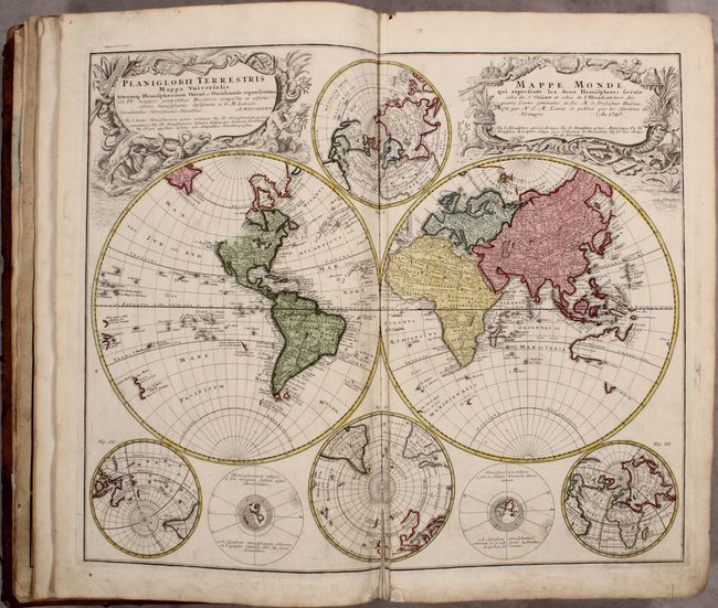
Planiglobii Terrestris Mappa Universalis... This handsome double-hemisphere world map was drawn by Georg Moritz Lowitz, based on the work of Johann Mathias Haas. It includes four polar spheres, each in a different projection, and two interesting diagrams depicting the earth, as it would be seen from space. North America is still blank above California and Hudson Bay is open-ended in the northwest corner. The large, mythical Xarayes Lake appears in the center of South America. In the South Pacific there are partial coastlines of New Zealand, Australia and Tasmania. Two very large, decorative cartouches contain the titles, one in Latin, the other French.
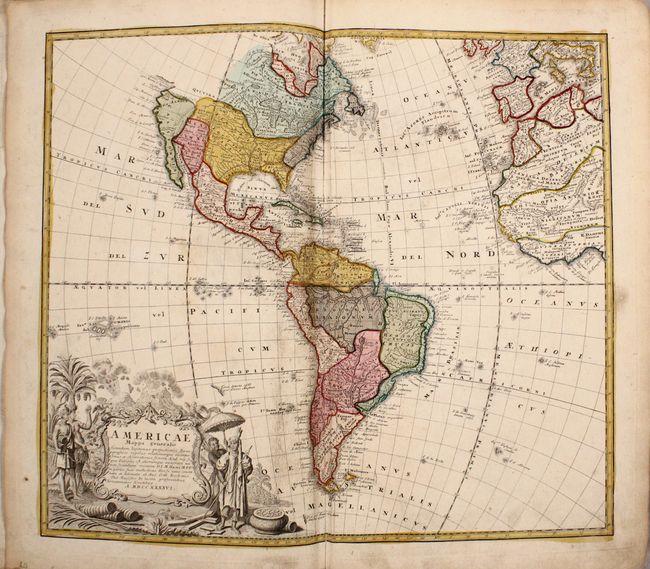
Americae Mappa Generalis... This attractive map of the Americas includes considerable detail throughout. It extends to the western part of Africa and southwest Europe. There is only an amorphous coastline shown above the peninsular California, with the Pacific Northwest left blank. The very large title cartouche includes two erupting volcanoes, Native Americans, palm trees, sugar cane, parrots, and a pot of gold.
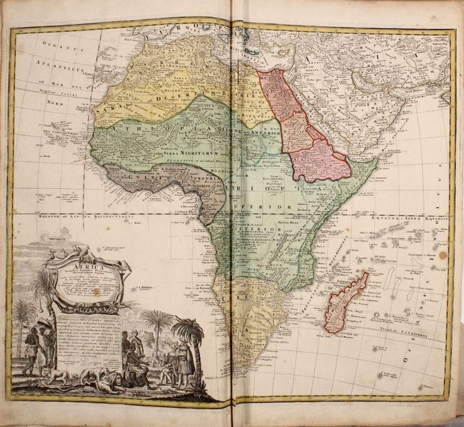
Africa Secundum Legitimas Projectionis... This map presents a fairly accurate picture of the continent without most of the fictitious lakes and rivers of previous cartography. It focuses on the known coastal regions of the continent, leaving the interior blank or marked Terra Incognito. Egypt, Nubia and Abyssinia are shown as distinct entities, Lake Nyasa is shown as Lac Marawi, and the Congo is located. The Dutch settlements of Castell Batov and Stellenbosch are shown at the Cape. The most striking feature of the map is the large title cartouche that is framed by elephant tusks and a horned serpent. In the foreground is a scene of natives negotiating with European traders, surrounded by indigenous animals.
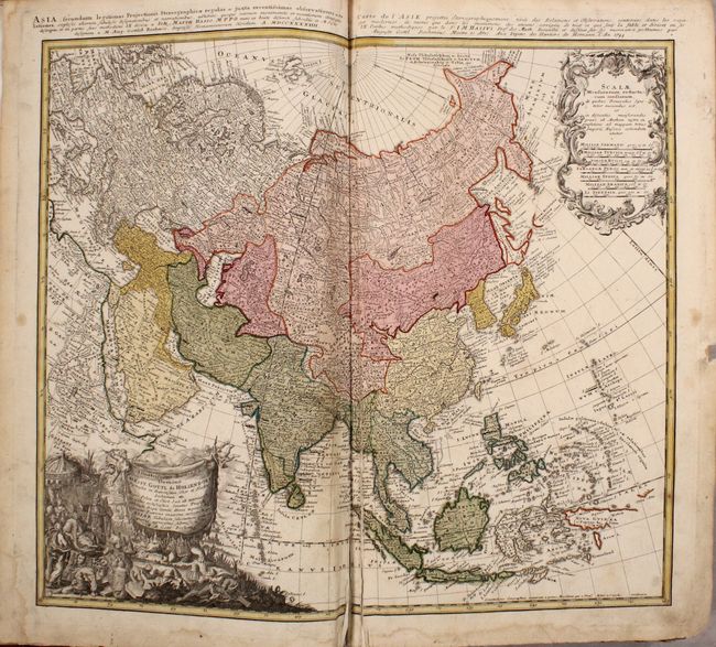
Asia Secundum Legitimas Projectionis... The extent of European knowledge in Asia is vividly depicted on this map of the continent and the East Indies. The work of the Jesuit missionaries is reflected in the well-documented region of China. Kamchatka has been reduced to its proper size from Johan Christoph Homann's earlier map, while Siberia is clearly based on Russian surveys that were published in the early 1730's. Japan is still shown with Hokkaido (Terra Eso Yedso Oku Yeso) attached to the mainland. The title runs across the top neatline in both Latin and French.
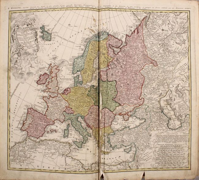
Europa Secundum Legitimas Projectionis... This decorative map of Europe is based upon Haas' stereographic horizontal projection and has good detail throughout. A large decorative cartouche features Europa, crowns, horse heads, putti and the figure of Fame with her trumpet. A handsome chart that extends to include Iceland, the Mediterranean, and part of Northern Africa.
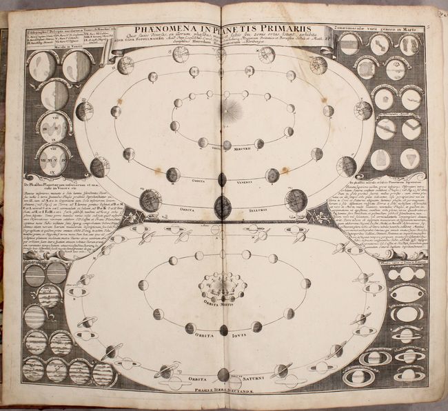
Phaenomena in Planetis Primariis... This chart shows the phases of the planets as viewed from Earth, including Mercury, Venus, Mars, Jupiter, and Saturn. Also shows are the aspects of Saturn's rings, as well as the markings on the planets Venus, Mars, and Jupiter based on the observations of Christoph Scheiner, Galileo Galilei, Christiaan Huygens, Giovanni Domenico Cassini, Robert Hooke, Jacques-Philippe Maraldi and Francesco Bianchini.
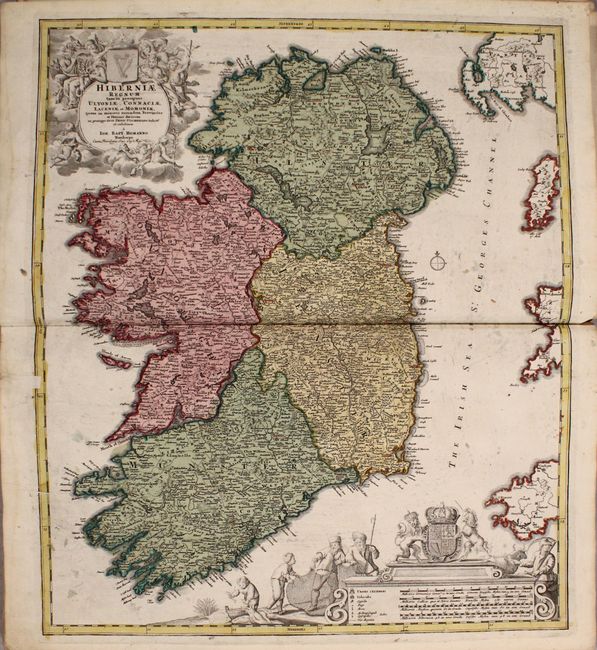
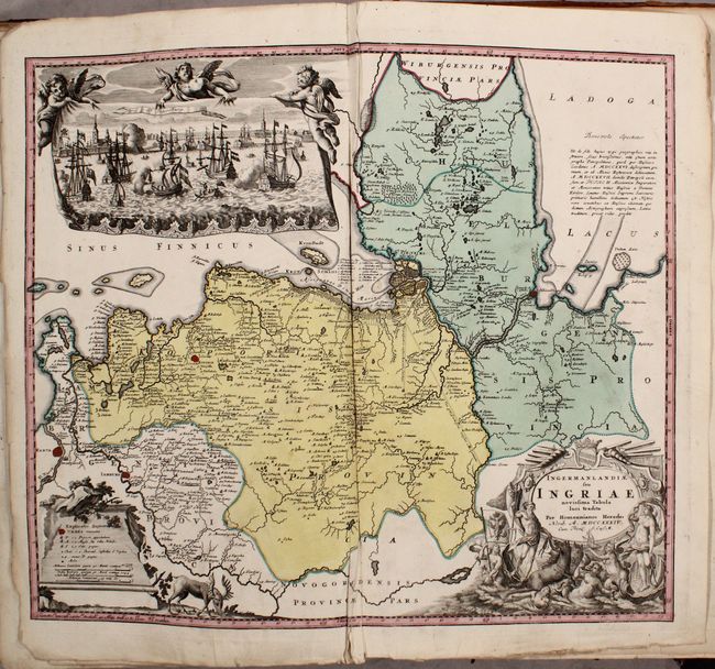
Additionally, there are 100 regional maps of Europe including Imperii Russici et Tartariae Universae..., which extends across the entire Russian Empire and Northern Asia and includes China, Korea, Japan, and Formosa. There are also maps of the Turkish Empire (Imperium Turcicum in Europa, Asia et Africa Regiones Proprias...), Persian Empire (Imperii Persici...), and China (Regni Sinae vel Sinae Propriae...). The atlas includes a duplicate of Imperii Romano-Germanici..., and an additional loose Homann Heirs map of the Holy Land has been inserted.
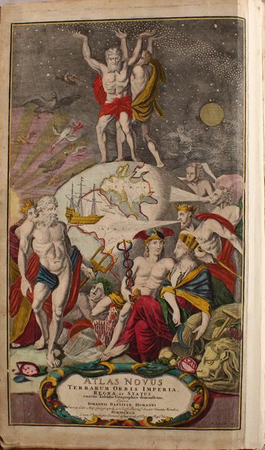
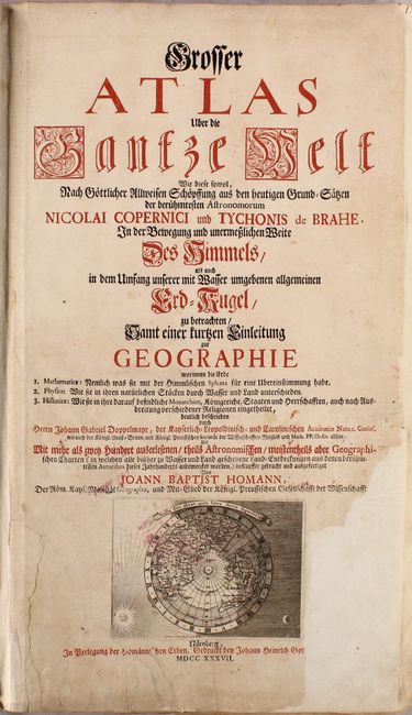
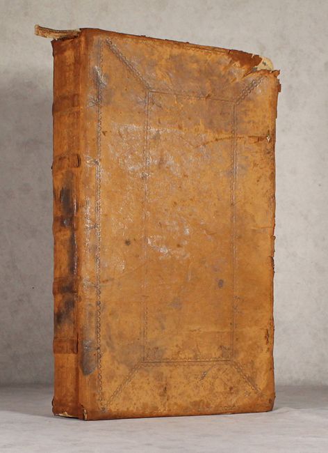
The title page is printed in red and black ink with a polar projection map of the northern hemisphere engraved by Johann Georg Ebersperger at bottom showing California as an island. According to the title page, the publication date is 1737, but several of the individual maps are dated later, with the latest dated 1751. Opposite the title page is an allegorical frontispiece engraved by Michael Rossler with the title Atlas Novus Terrarum Orbis Imperia... It shows Atlas and Hercules standing atop a globe and holding up the heavens. A manuscript table of contents is pasted to the rear endpaper. Hardbound in full contemporary leather with raised bands and faded gilt title on spine.
References:
Condition: B
The maps are in contemporary color with many dark, attractive impressions. The world and continents maps are in B condition with light to moderate soiling and extraneous creasing and/or tears, especially around the centerfolds. The rest of the maps range from A to B condition, with the majority in B+ condition. Common condition issues include light soiling, extraneous creases parallel to the centerfold, and edge tears, some of which have been closed with old paper. Map 106 (<i>Fluviorum in Europa Principis Danubii </i>) is loose. There is faint damp staining along the bottom of the atlas, with the stain passing the neatline in some of the maps towards the end of the volume. There is a large chip at bottom right and several edge tears on the title page which have been backed with old paper on verso. Hinges are starting. Covers are heavily chipped and worn with bumped corners.