Subject: Philippines
Period: 1899 (dated)
Publication:
Color: Printed Color
Size:
15.5 x 22.2 inches
39.4 x 56.4 cm
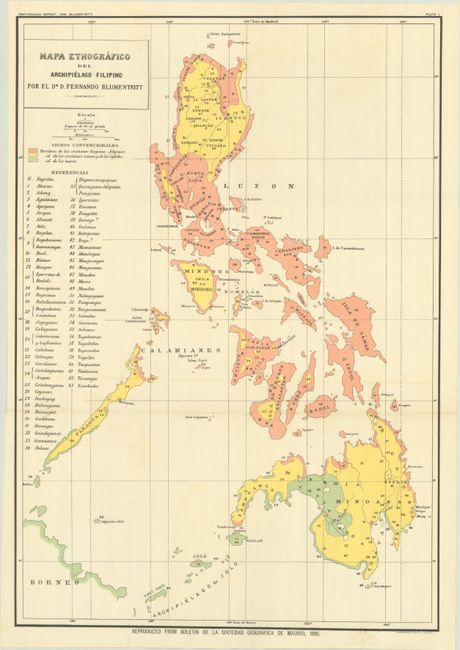
This map, created by Ferdinand Blumentritt, was originally issued in the Boletin de la Sociedad Geografica de Madrid and here issued in a Smithsonian report shortly after the United States assumed control of the Philippines and on the cusp of the Philippine-American War (1899-1902). It does not emphasis physical features or political boundaries like most wartime maps do, but instead presents ethnography. The map is color-coded to show Christian Filipinos, new Christians and non-believers, and Muslim regions. In addition, 63 different local tribes are keyed to the map providing a complete perspective of the inhabitants on these islands. Lithographed by Norris Peters in Washington.
References: Phillips (Philippine Islands) #473.
Condition: A+
Fine. Issued folding.