Catalog Archive
Auction 191, Lot 697
"Mapa Etnografico del Archipielago Filipino",
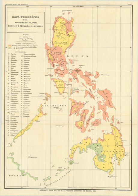
Subject: Philippines
Period: 1899 (dated)
Publication:
Color: Printed Color
Size:
15.5 x 22.2 inches
39.4 x 56.4 cm
Download High Resolution Image
(or just click on image to launch the Zoom viewer)
(or just click on image to launch the Zoom viewer)