Subject: China & Korea
Period: 1700 (circa)
Publication:
Color: Hand Color
Size:
20.7 x 18.5 inches
52.6 x 47 cm
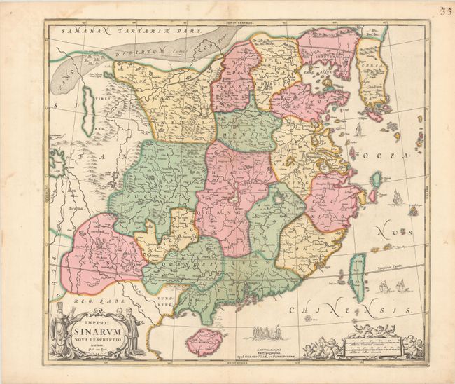
This superb map of the Chinese Empire is drawn largely from the Blaeu map compiled by Jesuit Father Martino Martini who traveled through the region between 1643 and 1650. It deviates from that model in its depiction of the Korean peninsula, which is shown with a cluster of islands at its southern tip. The map is embellished with sailing ships and Chinese junks. The title cartouche is flanked by Chinese and Jesuit men and the scale of miles cartouche is surrounded by putti. Engraved by Johannes van Loon and first issued by Jan Jansson in his Atlas Novus in 1657; this is the later re-issue by Gerard Valk and Peter Schenk. Blank verso.
References: Van der Krogt (Vol. I) #8410:1C.
Condition: A
A crisp impression on a bright sheet with full contemporary color and a light dampstain just entering the map at top left.