Subject: Asia
Period: 1788 (dated)
Publication:
Color: Hand Color
Size:
24.8 x 19.3 inches
63 x 49 cm
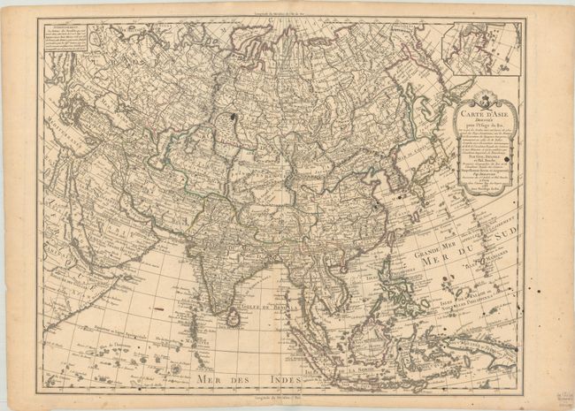
This scarce map of Asia is a revision of Delisle's 1700 map of the continent. In this map, Dezauche completes the coastline of northeastern Siberia between Novaya Zemlya and Japan, with Novaya Zemlya correctly shown as an island and the peninsula of Kamchatka now appearing. A small inset at top right shows the northeastern tip of the continent with a rudimentary Alaska with the note that Captain Cook had been stopped by the ice in that area. The Sea of Japan is noted as Mer de Coree. Hokkaido (Isle de Ieso) is no longer attached to Japan but is still poorly shaped. To the east are the conjectural islands of Terre de la Compagnie and Terre de J. de Gama, which is also labeled Kia-ytao.
References:
Condition: B+
Contemporary outline color on a lightly toned sheet with old splatters of ink, minor foxing, and a couple of short tears at bottom that have been repaired on verso.