Subject: Asia
Period: 1678 (circa)
Publication:
Color: Hand Color
Size:
22.8 x 19.3 inches
57.9 x 49 cm
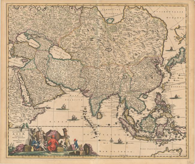
This large and handsome map of the continent and East Indies shows the extent of European knowledge of the region. It is vividly rendered with good detail throughout the south and southeast, due to the surveys of the Dutch East India Company, while northern and central Asia is filled mostly with mountains, deserts, and forests. The work of the Jesuit missionaries is reflected in the well-documented region of China. Japan is shown on the Blaeu/Martini type with Yedso as a disembodied coastline in the sea above Japan. Corea is shown as a small peninsula. The large, mythical Chiammay Lacus, located in central China, spawns five major south-flowing rivers. At the very bottom, the northern tip of Australia is depicted. The large title cartouche features a busy scene including traders with their exotic cargo.
References: Carhart (De Wit) #10.2; Yeo #59.
Condition: B+
A nice impression with full contemporary color on a lightly toned sheet. A short tear at top and a centerfold separation at bottom have been archivally repaired.