Subject: Middle East
Period: 1753 (dated)
Publication:
Color: Hand Color
Size:
21.8 x 19.1 inches
55.4 x 48.5 cm
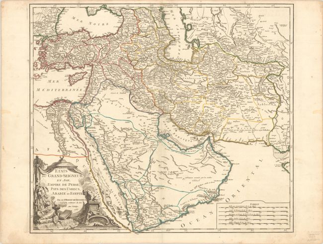
This is a handsome and detailed copper-engraved map centered on the Arabian Peninsula, here called Arabie Heureuse. The map shows the Black and Caspian Seas, and extends to include modern Turkey, Persia, Syria, Israel, Saudi Arabia, Iraq, Iran (Persia), Uzbekistan, and much of Afghanistan. A Grand Desert is located between Mecca and Oman, today known as the Rub' al-Khali desert. The map is adorned with a decorative cartouche showing a Turkish sultan seated on pillows, smoking a long pipe, and five distance scales at lower right.
References: Ankary #184, pp. 352-53; Pedley #389.
Condition: A
A crisp impression with contemporary outline color on a bright sheet with the Society of Jesus watermark and light soiling that is mostly confined to the blank margins.