Subject: Southwestern France
Period: 1730 (circa)
Publication:
Color: Hand Color
Size:
25.1 x 19.1 inches
63.8 x 48.5 cm
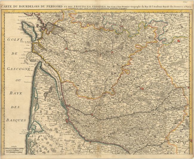
This densely detailed map depicts the Bourdeaux wine regions and their surroundings. It spans from La Rochelle to Cahors in the southeast. Bourdeaux, Saintes, Cognac, Angouleme, Limoges, Perigueux, and Libourne are among the many towns and cities identified. There is fine topographical detail throughout the map. Isle Oleron is located. There are three distance scales at bottom left. Originally published in 1714, this edition was published by Covens & Mortier in Amsterdam.
References:
Condition: B+
A sharp impression with contemporary outline color. There is light soiling and toning that is most apparent along the centerfold and edges of the sheet, and minor offsetting.