Subject: North Sea & Britain
Period: 1675 (circa)
Publication: Orbis Maritimus ofte Zee Atlas
Color: Hand Color
Size:
22.3 x 19.3 inches
56.6 x 49 cm
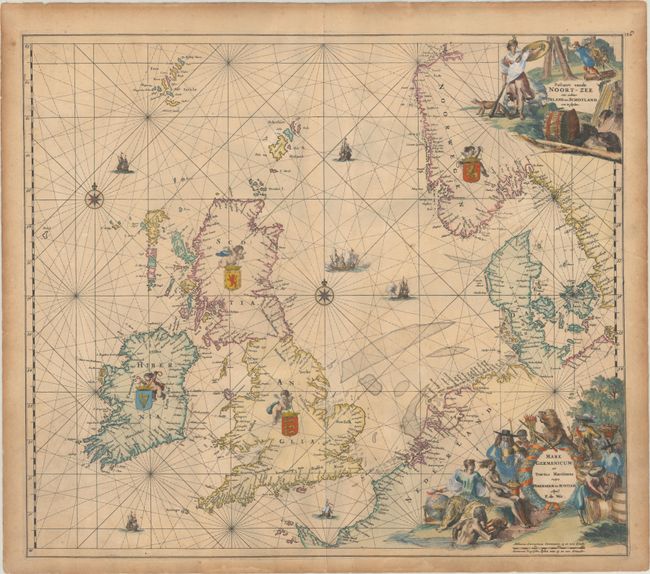
This beautiful sea chart of the North Sea includes the British Isles, the Faroe Islands, and the stretch of coastline extending from Norway south to Normandy. It includes two compass roses and is crisscrossed by rhumb lines. The seas are filled with sailing ships and a naval battle, and putti hold aloft the coats of arms of Ireland, Scotland, England, and Norway. Soundings appear throughout. There is a Dutch title cartouche at top right that features Athena with a fox and a bear and a logging scene. An additional Latin title cartouche at bottom right shows various allegorical figures including Neptune, Urania, and the States Lion with his sword and arrows.
References:
Condition: B+
A crisp impression on a sturdy sheet with light toning that is heavier along the edges of the sheet. There is an extraneous crease at right and a tiny tear in the right margin that has been closed on verso with archival tape. There are small remnants of hinge tape on verso.