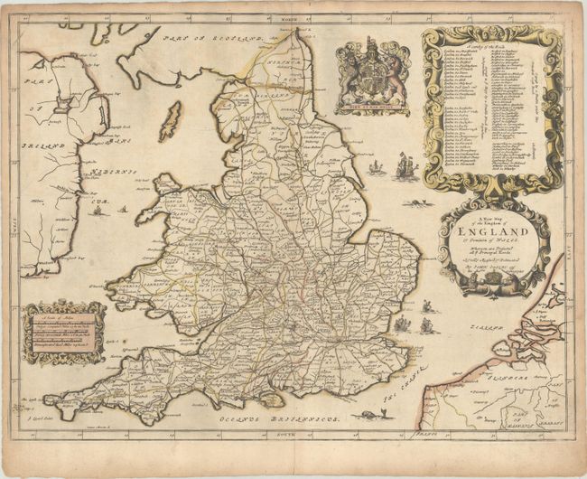
Subject: England & Wales
Period: 1675 (circa)
Publication: Britannia
Color: Hand Color
Size:
19.8 x 14.9 inches
50.3 x 37.8 cm
This map details the roads in England and Wales and was the first map in John Ogilby's Britannia, a landmark in the mapping of England and Wales. It was composed of maps of major roads and cross-roads, presented in a continuous strip-form, on a uniform scale of one inch to a mile, and was the first national road-atlas of any country in Western Europe. This map identifies towns, cities and counties and includes a detailed list of roads in an ornate strapwork cartouche at top right. The map is further embellished with the Royal coat of arms, sea monsters, and sailing ships flying the St. George Cross and the Dutch flag to symbolize the close relationship between England and Holland. Engraved by Joseph Moxon.
References: Shirley (BL Atlases) T.OGIL-4a #1a.
Condition: B+
An old-colored example on a sheet with a bunch of grapes watermark, light soiling, and toning along the edges of the sheet.