Subject: Northern England
Period: 1695 (circa)
Publication: Britannia
Color: Black & White
Size:
16.8 x 14.4 inches
42.7 x 36.6 cm
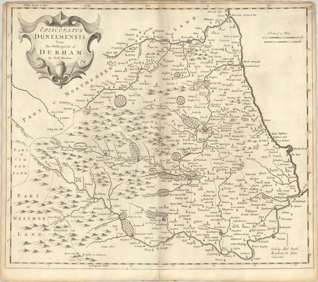
Fine decorative map of Durham showing cities, fortifications, hills, forests, parks, villages, castles, and more. The map is adorned with a strapwork title cartouche. Sold by Abel Swale Awnsham and John Churchil.
Morden was one of the first English cartographers to show longitudes measured from the meridian of St. Paul's Cathedral (shown in degrees at the bottom of the map) and time in minutes measure locally from the sun (shown at the top in Roman numerals). The roads on his maps are based on Ogilby's earlier survey. The Britannia was first published by historian William Camden (1551-1623) in 1586. After the publication of the final edition of Britannia in 1637, the work was not published again until 1695 when Gibson revised and translated the text from the original Latin. He included fifty maps, mostly of the English counties, prepared by Robert Morden, replacing the outdated maps of Christopher Saxton.
References: Shirley (BL Atlases) T.CAMD-5a.
Condition: B+
A nice impression with light soiling, minor toning along the centerfold, and a short centerfold separation in the bottom blank margin. Narrow top margin.