Subject: Iceland
Period: 1780 (circa)
Publication: La Harpe's Histoire Generale des Voyages
Color: Black & White
Size:
15.2 x 11.9 inches
38.6 x 30.2 cm
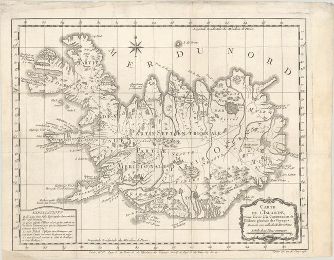
In 1752 the Danish scholar Niels Horrebow published an important book and map covering Iceland. His map, based on the previously unpublished Knoff survey, was a major departure from previous maps based on Bishop Gudbrandur Thorlaksson's map of more than 150 years earlier. Thus, it marked a turning point in the cartography of Iceland. This is Bellin's version for Prevost's important work on voyages of exploration. The map locates villages and churches and graphically delineates the mountains, rivers, lakes, and forests. A note at bottom left explains that there are only two Episcopalian villages on the island, which are so marked, and that the term "village" on this map simply identifies a location where commerce occurs when "the Danish negotiators arrive on the island."
References:
Condition: B+
A crisp impression issued folding, now flat, on a watermarked sheet. A couple folds are reinforced on verso with archival materials, and there are faint dampstains in the top margin, a few of which just enter the border.