Subject: Eastern Brazil
Period: 1664 (circa)
Publication: Grooten Atlas
Color: Hand Color
Size:
17.6 x 16.4 inches
44.7 x 41.7 cm
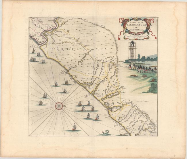
This fine map of the Brazilian coast is richly decorated with a scene of natives with a look-out tower and a huge fleet of ships. With north oriented to the right, the map covers the coastal region from Sao Francisco to about Recife. It was drawn after actual surveys by Georg Marcgraf, Elias Herckmanns, and others and was among the first maps of Brazil based on non-Portuguese data. Blaeu first issued this and its companion maps in 1647 for Gaspar Barleus' Rerum per octennium in Brasilia. They were also assembled into a large wall map, Brasilia qua parte paret Belgis. The maps then appeared in the Atlas Maior beginning in 1662. This example is the second state with the addition of a native in the watchtower. Dutch text on verso.
References: cf. Goss (Blaeu) pp. 184-185; cf. Van der Krogt (Vol. II) #9850/3:2D; Whitehead (TMC-40) pp. 17-20.
Condition: A
A dark impression with full contemporary color on a bright sheet with a large watermark of the god Atlas and light printer's ink residue. There are light dampstains along the edges of the sheet, well away from the image.