Subject: Martinique, North America
Period: 1722 (published)
Publication:
Color: Black & White
Size:
3.9 x 6.4 inches
9.9 x 16.3 cm
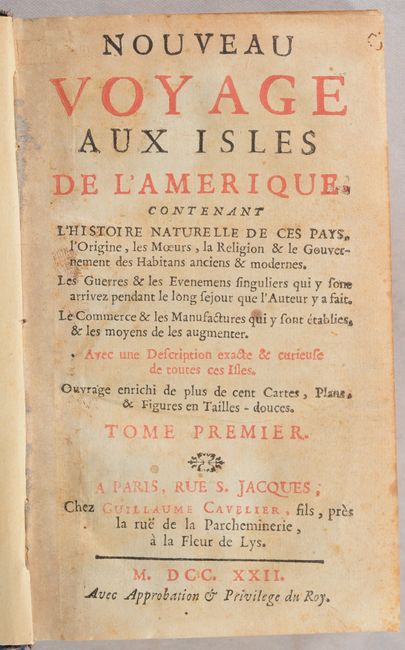
This is the fascinating first volume of Jean-Baptiste Labat's Nouveau Voyage aux Isles de l'Amerique, which consisted of six volumes in its first edition. Labat (1663-1738) was a Paris-born clergyman, slave owner, botanist, and engineer who lived on Martinique from 1694 until 1706. While he lived on the island, he modernized its sugar industry, contributed to its infrastructure as an engineer, and wrote about its history, culture, and wildlife. The first volume includes three maps:
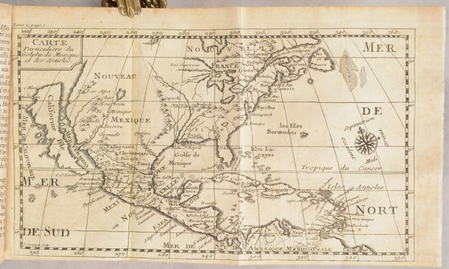
Carte Particuliere du Golphe de Mexique et des Antisles (9.8 x 5.6"). Engraved by J.B. Sornique, this small map of North America features California as an island with a flat northern coast. C. Blanc, C. Mendocina, C. de Pinas, and C.S. Lucas are identified on the island. There is virtually no detail in the Pacific Northwest, and the title cartouche conveniently fills the region. The Rio Grande is shown erroneously emptying into the Gulf of California, the Great Lakes are open-ended in the west, and a large fictitious inland lake (Lake May) can be found in western North Carolina. Decorated by a simple block-style cartouche and fleur-de-lis. Reference: McLaughlin #202; Wagner #524. Condition: A crisp impression issued folding with light toning and offsetting. (B)
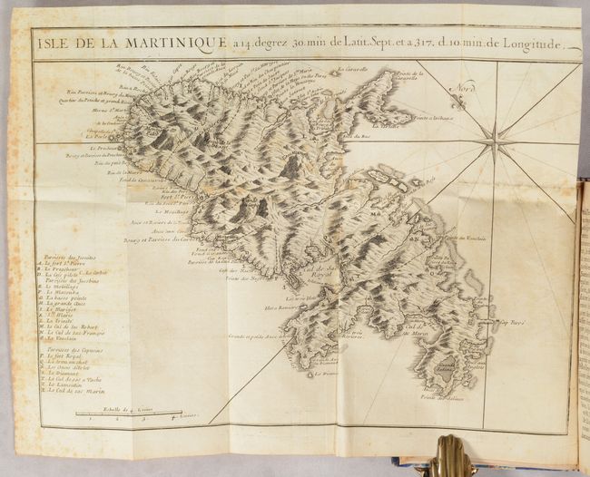
Isle de la Martinique... (11.9 x 8.8"). This superb map of Martinique depicts the island in intricate topographical detail, with relief shown pictorially. The key at bottom left identifies 21 places of interest. Anchorages are noted off the coast. A compass rose orients north to the top left. Condition: A nice impression issued folding with scattered foxing, minor offsetting, and a short binding trim and related tiny tear at right. (B)
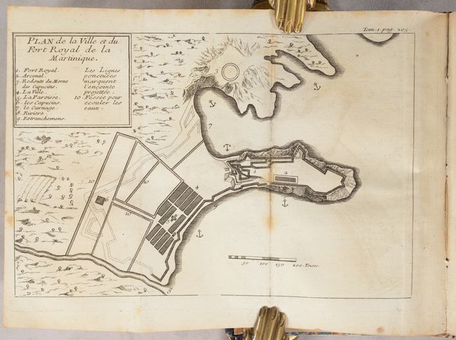
Plan de la Ville et du Fort Royal de la Martinique (7.8 x 5.1"). This handsome plan view depicts Fort Royal, now known as Fort-de-France. The key in the title cartouche locates 10 notable features, including fortifications, the town, arsenal, and more. Five anchorages are noted in the surrounding water. Condition: A crisp impression issued folding with light foxing, most noticeable along the right fold, and minor offsetting. (B+)
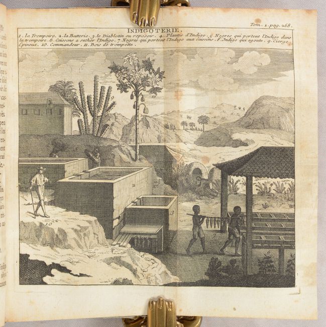
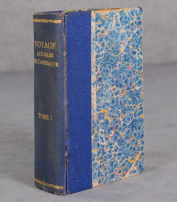
The book also features 3 plans of Fort Royal's arsenal and 11 additional engravings that include depictions of the indigo harvesting process, tortoises, avocados, pineapple, and more. Published by Guillaume Cavelier. 525 pages. Hardbound in quarter blue cloth over marbled boards.
References: Sabin #38409.
Condition:
See description above for condition of folding maps. Text has some light toning and foxing. Covers have light wear, bumped corners, and minor cracking along the joint. Rebound. Maps (B/B+), Binding (B+)