Subject: Lesser Antilles, Puerto Rico & Northern South America
Period: 1734 (circa)
Publication:
Color: Black & White
Size:
19.8 x 23 inches
50.3 x 58.4 cm
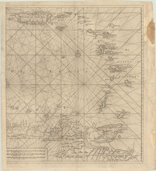
This is the eastern sheet of Van Keulen's rare and superb large sea chart of the eastern part of the Caribbean Sea. The sheet spans from St. Juan de Porto Rico south through the Lesser Antilles to northern South America. It provides a detailed view of the coastlines with anchorages, shoals, soundings and other navigational information carefully noted. The chart was apparently first compiled in the latter part of the 17th century and then updated here with information from Captain Jean Bertrand who sailed between the Netherlands and the West Indies from 1726-1734. Engraved by J. Stemmers. The Van Keulens often used information gathered from hydrographers and sea captains for their charts. Until the opening of the Dutch Hydrographic Office in the 19th century, the Van Keulen firm issued what were regarded as the official Dutch sea charts.
References:
Condition: B
A nice impression with some extraneous creasing, a few small stains in the lower portion of the image and right blank margin, and printer's ink residue. Issued folding with a few small fold separations.