Catalog Archive
Auction 191, Lot 377

"Dominia Anglorum in Praecipuis Insulis Americae... / Die Englische Colonie-Laender auf den Insuln von America...", Homann Heirs

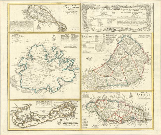
Subject: Caribbean & Bermuda

Period: 1759 (circa)

Publication:

Color: Hand Color

Size:
22.2 x 19.4 inches
56.4 x 49.3 cm
Download High Resolution Image
(or just click on image to launch the Zoom viewer)

A large and striking sheet that contains five charts describing the islands of St. Kitts, Antigua, Bermuda, Barbados, and Jamaica. All of these maps were copied from separate maps made by Herman Moll in 1729. Each is finely engraved and meticulously detailed with its own compass rose, soundings, roads, forts, churches, topography, and political divisions, as well as descriptive text and place name keys. The map has a second title in German: Die Englische Colonie-Laender auf den Insuln von America. This is the second state with Bermuda changed from "Bermudos" to "Bermudes."

References: Evans (Bermuda) Homann's Heirs [1737]; Sellers & Van Ee #1723.

Condition: A

A crisp impression on a bright sheet with minor printer's ink residue and soiling.

Estimate: $275 - $350

Sold for: $200

Closed on 2/8/2023

Archived