Subject: Mexico City, Mexico
Period: 1753 (published)
Publication: Histoire Generale des Voyages...
Color: Hand Color
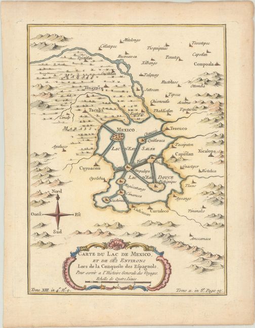
A. Carte du Lac de Mexico, et de ses Environs Lors de la Conqueste des Espagnols, pour Servir a l'Histoire Generale des Voyages, (6.1 x 8.3"). Map showing Mexico City as it was when discovered by the Spaniards. The city is located in a large lake with a series of causeways linking the main city and other islands in the Lac d'Eau Salee with the mainland. Tacuba, Capistlan, Xicolopa, and Curtaleco are located in the surrounding countryside. Condition: A crisp impression with marginal toning.
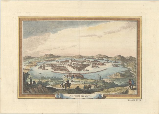
B. Ancien Mexico, (10.4 x 7.1"). This bird's-eye view depicts Mexico City or Tenochtitlan as it was before its destruction by the conquistador Hernan Cortes. The city's complex of islands and bridges is well rendered, as is the surrounding mountainous terrain. In the foreground there are Spanish explorers moving toward the city. Condition: On watermarked paper.
References:
Condition: A
See description above.