Catalog Archive
Auction 191, Lot 343

"[Maps in Report] Plan of the Battlefield of the Four Lakes Sept. 1st 1858…[and] Plan of Col. Steptoe's Battlefield on the Ingossomen Creek... [in] Report of the Secretary of War...", U.S. War Department

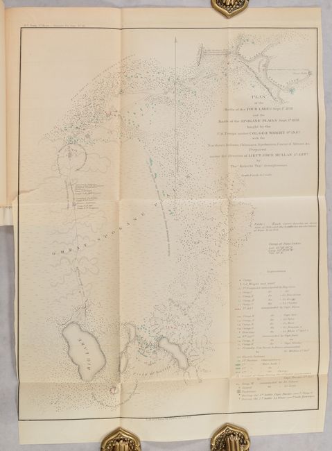
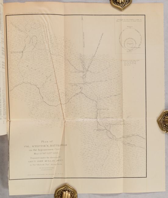
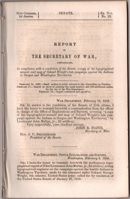
Subject: Washington, Spokane Indian Wars

Period: 1859 (published)

Publication: Sen. Ex. Doc. 32, 35th Congress, 2nd Session

Color: Black & White

Size:
9.8 x 11.6 inches
24.9 x 29.5 cm
Download High Resolution Image
(or just click on image to launch the Zoom viewer)

Indian wars in Washington Territory were a constant threat during the years following the 1846 division of the Oregon Country from British North America. With the discovery of gold near Colville, Indian hostilities were renewed in the Spokane War of 1858. The first map (12.3 x 16", hand color) depicts the decisive defeat of the Indians at Four Lakes and Spokane Plains. The second (9.8 x 11.5", black & white) illustrates the Indian successes against Col. Steptoe's forces. Both maps were prepared under the direction of Lieut. John Mullan of the 2nd Artillery. The maps are still bound into the original 82-page report. Disbound.

References:

Condition: B+

The folding maps are lightly toned with short binding tears. The second map (Steptoe's Battlefield) also has some extraneous creasing. Disbound text is mostly clean and bright.

Estimate: $250 - $325

Sold for: $145

Closed on 2/8/2023

Archived