Subject: Tennessee
Period: 1814 (circa)
Publication: Carey's General Atlas
Color: Hand Color
Size:
20.4 x 9.6 inches
51.8 x 24.4 cm
Mathew Carey was a seminal figure in early American publishing; establishing the first publishing firm to specialize in cartography and issuing the first atlas devoted exclusively to American maps. He set up an elaborate cottage system of craftsmen for compiling, engraving, printing, and coloring maps. This practice was emulated by later American cartographic publishers such as John Melish and Henry S. Tanner. The American Atlas concept was also adopted by other publishers in both the United States and Europe.
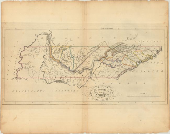
This fine map of Tennessee shows the state at an early point in its development with only twelve organized counties in the Mero and Washington Districts. The majority of the state is shown to be Cherokee tribal territory. The map depicts a few settlements, forts, trails, and roads, two of which venture out into Cherokee country toward the Tennessee River.
References: Phillips (Atlases) #1372-22.
Condition: B+
Issued on star watermarked paper with light toning along the centerfold, faint offsetting, a few spots of foxing, and small chips and tears along the edges of the sheet. Centerfold separations at top and bottom are confined to the blank margins and have been closed on verso with archival tape. Trimmed close by the binder at left and right.